Sweaters Out, Umbrellas Up: The UK Swaps Warm Spells for Stormy Skies
Anyone who packed away their warm layers last week might want to rethink things. After days of sunshine and rare warmth—eastern Wales and southern England even flirted with 24°C—the UK’s weather has completely flipped. The Met Office isn’t mincing words: active weather warnings are now in place for four regions, thanks to a stubborn cold front turning temperatures and conditions upside down.
What’s behind this chilly turnaround? Forecasters Tony Wisson and Honor Criswick are pointing fingers at a sharp push of cold air moving in fast from the north-west. We’re not talking about a gentle cool-down either. Some spots have seen the mercury fall as much as 10°C in just a day or two—a big shock for anyone enjoying the short-lived heatwave. One day, you’re basking in sunshine, the next you’re dodging showers and shivering under the same skies.
The Met Office hasn’t named every exact region in the latest public reports, but here’s what forecasters are highlighting as the trouble spots:
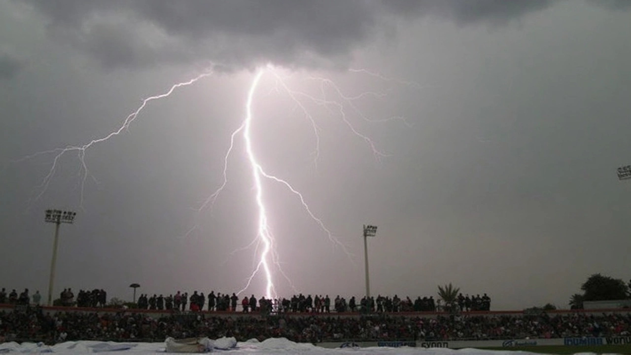
- Southern and western areas: Bursts of thundery showers breaking out, bringing the risk of local downpours and even some lightning.
- Eastern Scotland: Cloudy skies with persistent showers, dampening plans and keeping things grey.
- Southern England’s coasts: Patchy, unsettled rain sweeping through, keeping beachgoers on their toes.
- Northern regions: Temperatures dropping off sharply, with some places noting an almost winter-like chill, especially after early week warmth.
The quick change has caught plenty of people off guard. It wasn’t long ago that parks, gardens, and pub patios from Cardiff to Cambridge were buzzing as folks made the most of rare T-shirt weather. High pressure was the hero then, keeping skies clear and the sun beaming. But as that system retreated, a cold front muscled in, scattering those blue skies and pulling down the thermostat.
This isn’t just a matter of a few showers, either. Meteorologists stress that the new front is stirring up genuine instability. Those thundery showers can pop up in unexpected places and dump a lot of rain in a short time, leading to brief but intense disruption. Lightning can’t be ruled out, especially in the south and west where storms build more easily on the back of leftover warmth.
For much of the west, things look a bit less dramatic. Drier spells will hold on, at least for now, but forecasters are clear: the atmosphere is restless. Local variations—even within a single county—are likely, so neighborhoods could see big differences in rain, wind, or even brief sunshine.
So what’s the advice? Keep an eye on those Met Office updates. The warnings might shift as the front moves and the atmosphere reacts. Commuters might want to plan for surprises—wet roads, slick pavements, and slower travel in places hit by heavier showers. If you’re heading outside, layers and a waterproof might make all the difference, no matter how things looked at breakfast time.